

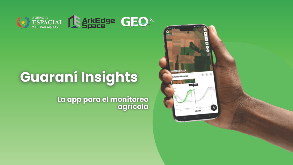
Tokyo, Japan, November 25, 2025 – ArkEdge Space Inc. (“ArkEdge Space”), a Japanese space startup based in Tokyo that provides comprehensive solutions from planning and design to mass production and operation of micro-satellite constellations, today announced that Guaraní Insights, a geospatial information platform jointly developed with the Paraguay Space Agency (Agencia Espacial del Paraguay, “AEP”). The platform was formally released in Paraguay on November 13, 2025.
Guarani Insights is part of ArkEdge Space’s international expansion of data services through its geospatial information platform, ArkEdge Insights®. Developed in collaboration with AEP to address the needs of local users, Guaraní Insights enables users to monitor agricultural fields and crop conditions without specialized analytical expertise or dedicated software.
Addressing Local Challenges Through ArkEdge Insights
ArkEdge Space provides ArkEdge Insights®, a geospatial information platform that connects space-derived and ground-based data to help address challenges facing local communities and industries. By integrating satellite data with other geospatial information, the platform provides a common infrastructure and applications that support on-the-ground operations and decision-making.
Guarani Insights was jointly developed with AEP as part of the ArkEdge Insights initiative in Paraguay. Developed with consideration for local environmental conditions, agricultural practices, and user workflows, the platform makes relevant information easily accessible and supports the practical use of satellite data in agricultural operations.
About Guarani Insights
Guaraní Insights is a geospatial information platform that allows users to access satellite imagery and analysis results through web browsers on smartphones and computers. The platform currently supports agricultural producers, researchers, and government officials through the following features:
・Field Registration and Management
Users can register agricultural fields on a map and organize and review information for each field.
・Crop Monitoring
Using vegetation and moisture indices, users can monitor crop conditions and changes over time for individual fields. This information helps identify areas requiring on-site inspection and prioritize field monitoring activities.
・Support for Administrative Procedures
The platform enables seed producers to efficiently prepare objective data required for applications for production plan certification, a mandatory procedure in Paraguay. It also helps certification authorities streamline their certification processes.
These features allow users to access information needed for on-the-ground decision-making without having to acquire satellite imagery or perform complex analyses themselves.
Joint Development with AEP and Local Activities
Guaraní Insights was developed through nearly two years of collaboration between AEP and ArkEdge Space leading up to its official launch in November 2025. Throughout the development process, the two organizations engaged with local users and conducted validation activities to improve the platform’s usability and functionality.
To mark the official release, a launch ceremony was held in Paraguay, bringing together representatives from government agencies, research institutions, agricultural cooperatives, and agribusiness organizations. The event introduced potential applications of the platform in agriculture.
Since its launch, AEP has continued introducing Guaraní Insights to local stakeholders. In October 2026, AEP presented the platform to agricultural producers, faculty members, and students at the National University of Pilar in Paraguay. These activities support the practical use of satellite data for crop monitoring and agricultural decision-making.
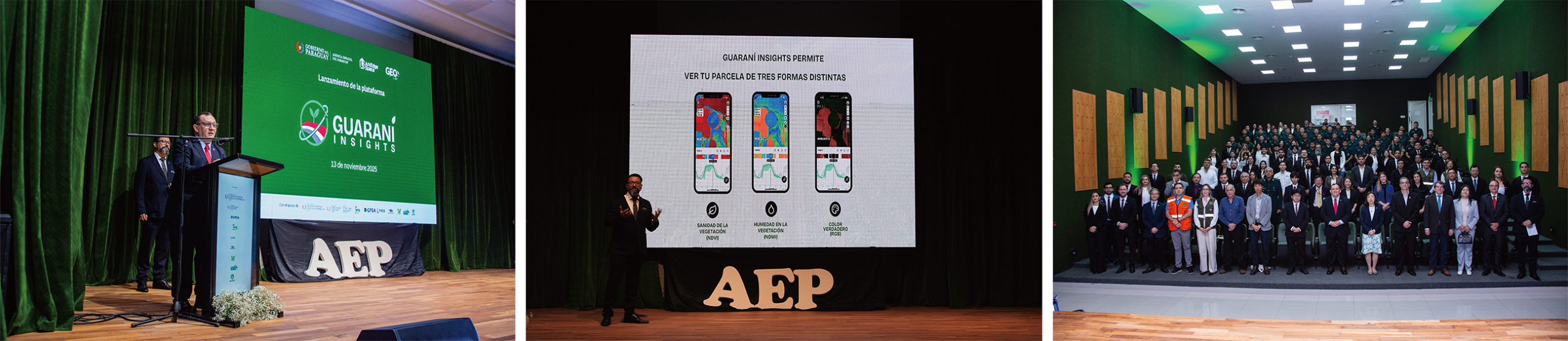
Launch ceremony: Presentations by the Director General of AEP and the Director of GEOLab, and group photo.
Future Developments
ArkEdge Space will continue working closely with AEP and other local partners and users to improve Guaraní Insights and promote its use. The company also aims to expand its applications beyond agriculture into areas such as water resource management and disaster risk reduction.
Building on the experience gained through joint development and local validation in Paraguay, ArkEdge Space will continue expanding ArkEdge Insights® to meet the needs of different countries and regions. Through its satellite development and operations capabilities and services that deliver practical data to end users, the company aims to advance space-based solutions that support communities and industries.
Related Links
Guaraní Insights Official Website: https://guaraniinsights.com/en/
Guaraní Insights Introduction Video: https://www.youtube.com/watch?v=rVhUDMq2kgc
About ArkEdge Space
ArkEdge Space is a Japanese space technology company offering end-to-end solutions for micro-satellite constellations—from planning and design to mass production and operations. Guided by its mission of “empowering people with satellites for a prosperous future,” the company is advancing capabilities in Earth observation, maritime satellite communications (VDES), optical communications, and low-Earth orbit satellite positioning, as well as lunar activities and deep space exploration. Through our mission, ArkEdge Space continues to drive the advancement of space innovation and its practical application.
Head Office Location
3F, Dome Ariake Headquarter, 1-3-33 Ariake, Koto-ku, Tokyo, Japan
CEO: Takayoshi FUKUYO
Founded: in July 2018
Website: https://arkedgespace.com/